Cargando...
Recursos educativos
-
Nivel educativo
-
Competencias
-
Tipología
-
Idioma
-
Tipo de medio
-
Tipo de actividad
-
Destinatarios
-
Tipo de audiencia
-
Creador
Lo más buscado
- Experimentos caseros
- Yoga para niños
- Jaume Cabré
- juegos lectoescritura
- Ártico
- Múltiplos de 5
- Capitales de África
- Francés-Lengua extranjera
- Arte islamico
- Actividades en la nieve
- Civilizaciones de la antigüedad
- Capitales de América
- Ejercicios escolares para niños de 8 años
- Países de África
- Unidades númericas
-
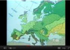
Geography Tutor - Map Skills
Tiching explorer Organización
- 1 lo usan
- 8123 visitas
Covers map directions, distances, scale, plotting latitude and longitude, common map symbols and features, and more.
-
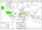
Printable world map
Tiching explorer Organización
- 7 lo usan
- 5159 visitas
Este recurso nos ofrece un completo generador de mapas mudos que nos permite diferentes variables ara personalizar: colorear países, introducir leyendas, trazar líneas, etc...El resultado final se…
-

Free Mind Map
Héctor Espinoza Hernández Docente
- 1 lo usan
- 4057 visitas
Edraw Mind Map is a vector-based mind mapping software. It allows us to create mind maps, brain-storming diagrams, project timeline, life planner, SWOT analysis and sketch maps. We need to download the…
-
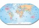
What is a map?
Maria Pallarés Docente
- 1 lo usan
- 5332 visitas
An introduction for young children to maps and the information they contain, including the colours and symbols on different types of maps. Duration: 4.32 minutes.
-
Free Mind Map
Tiching explorer Organización
- 2 lo usan
- 4750 visitas
Edraw Mind Map is a vector-based mind mapping software. It allows us to create mind maps, brain-storming diagrams, project timeline, life planner, SWOT analysis and sketch maps. We need to download the…
-
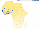
Map quiz: West Africa
Tiching explorer Organización
- 1 lo usan
- 4867 visitas
In this activity we have to click on the African countries to label them.
-
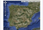
Satellite Map of Spain
Tiching explorer Organización
- 3 lo usan
- 4973 visitas
A satellite map of spain
-

Reading a map
Maria Pallarés Docente
- 1 lo usan
- 3942 visitas
This multimedia activity provides students the opportunity to learn the basic features of the topographic map and the main parts of the map: the legend, the scale, the direction indicator, etc.
-
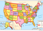
United States political map
Smart Organización
- 5446 visitas
SMART notebook resource. It includes states in 5 colors, with names, relief, and key rivers. We need to sign in to download the resource.
-
Map skills: scale
Maria Pallarés Docente
- 1 lo usan
- 3893 visitas
Maps can’t show things the size they are in real life so they use scale to make things smaller. With this interactive multimedia activity students will learn that different scales are useful for…
Te estamos redirigiendo a la ficha del libro...


